McConnells Mill State Park: Slippery Rock Gorge, Covered Bridge & Glacial Geology

Quick Facts
- Location: Lawrence County (Portersville, PA)
- Size: 2,546 acres
- Terrain: Deep glacial gorge with massive boulders, steep cliffs
- Top Trails: Slippery Rock Gorge Trail (6.2 miles), Kildoo Trail (2 miles), Hell’s Hollow (0.5 miles)
- Unique: 1868 grist mill, 1874 covered bridge, whitewater kayaking, rock climbing, National Natural Landmark
McConnells Mill State Park is not your average walk in the woods. It is a rugged, boulder-strewn wilderness defined by the Slippery Rock Creek Gorge, a 400-foot-deep chasm carved by the violent draining of glacial lakes 20,000 years ago.
The result is one of the most dramatic landscapes in Pennsylvania. Massive sandstone boulders the size of house trailers litter the gorge floor. The creek roars with Class II-IV rapids. And in the center of it all sits a postcard-perfect historic grist mill and covered bridge.
⚠️ Warning: The rocks are genuinely slippery, especially when wet. The moss-covered sandstone offers zero traction. Wear boots with good grip and take your time.
Why Hike McConnells Mill?
This park is for those who like their geology raw and their history loud. The sheer scale of the gorge is humbling. You’re walking on the bottom of what was once a catastrophic flood channel created when glacial Lake Arthur and other ice-age lakes breached their dams.
It’s also a multi-sport paradise. When the water is up, whitewater kayakers flock to the rapids. Rock climbers test themselves on the Rim Road cliffs. And hikers tackle the Slippery Rock Gorge Trail, a section of the North Country Trail that is notoriously tough.
The park earned National Natural Landmark status in 1974 for its exceptional geological features.
The Trails: Choose Your McConnells Mill Adventure
If You Want the Gorge: Slippery Rock Gorge Trail
Slippery Rock Gorge Trail:
- Distance: 6.2 miles one-way (12.4 miles round-trip)
- Elevation: 400 ft descent/ascent (gorge depth)
- Time: 6-8 hours round-trip
- Difficulty: Strenuous (rocky, steep, boulder scrambles)
- Trailhead: McConnells Mill parking area or Eckert Bridge parking
- Best Time: Spring (April-May) for high water, fall (September 25-October 10) for foliage
- The Draw: Part of the North Country Trail. Follows the entire length of the gorge to Eckert Bridge
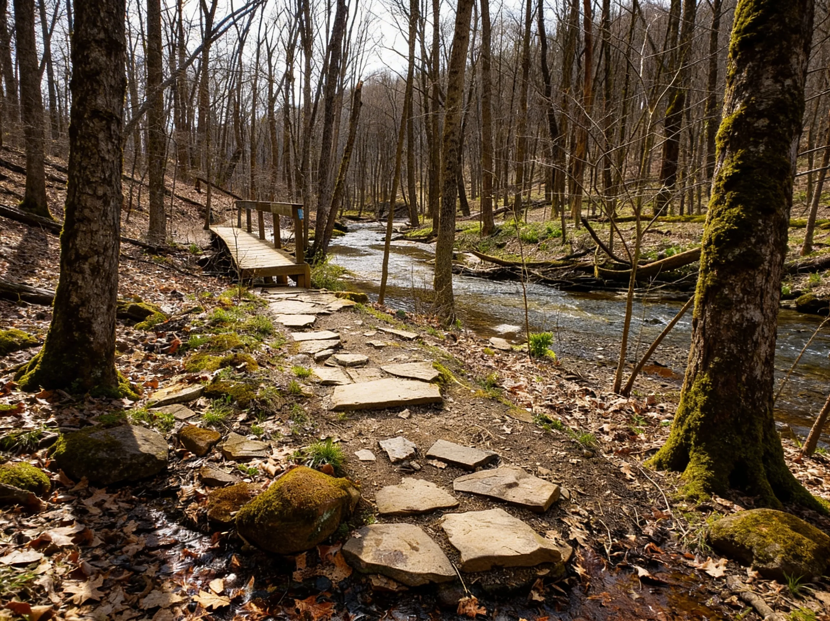
This is the real deal. The trail leaves the civilized area of the mill and plunges into the wilder sections of the gorge. You’ll scramble over boulders, cross tributary streams, and feel the isolation of the canyon.
The blue-blazed trail follows Hell Run Valley before descending into the gorge proper. Massive boulders force you to pick your way carefully. In places, you’ll use your hands to navigate rock scrambles.
Pro Tip: This is a serious hike. Allow 6-8 hours for the round trip, or park a second car at Eckert Bridge for a one-way shuttle hike (6.2 miles). Trekking poles are highly recommended. The rocks are slippery year-round, but especially treacherous after rain.
If You Want the Waterfall: Hell’s Hollow Trail
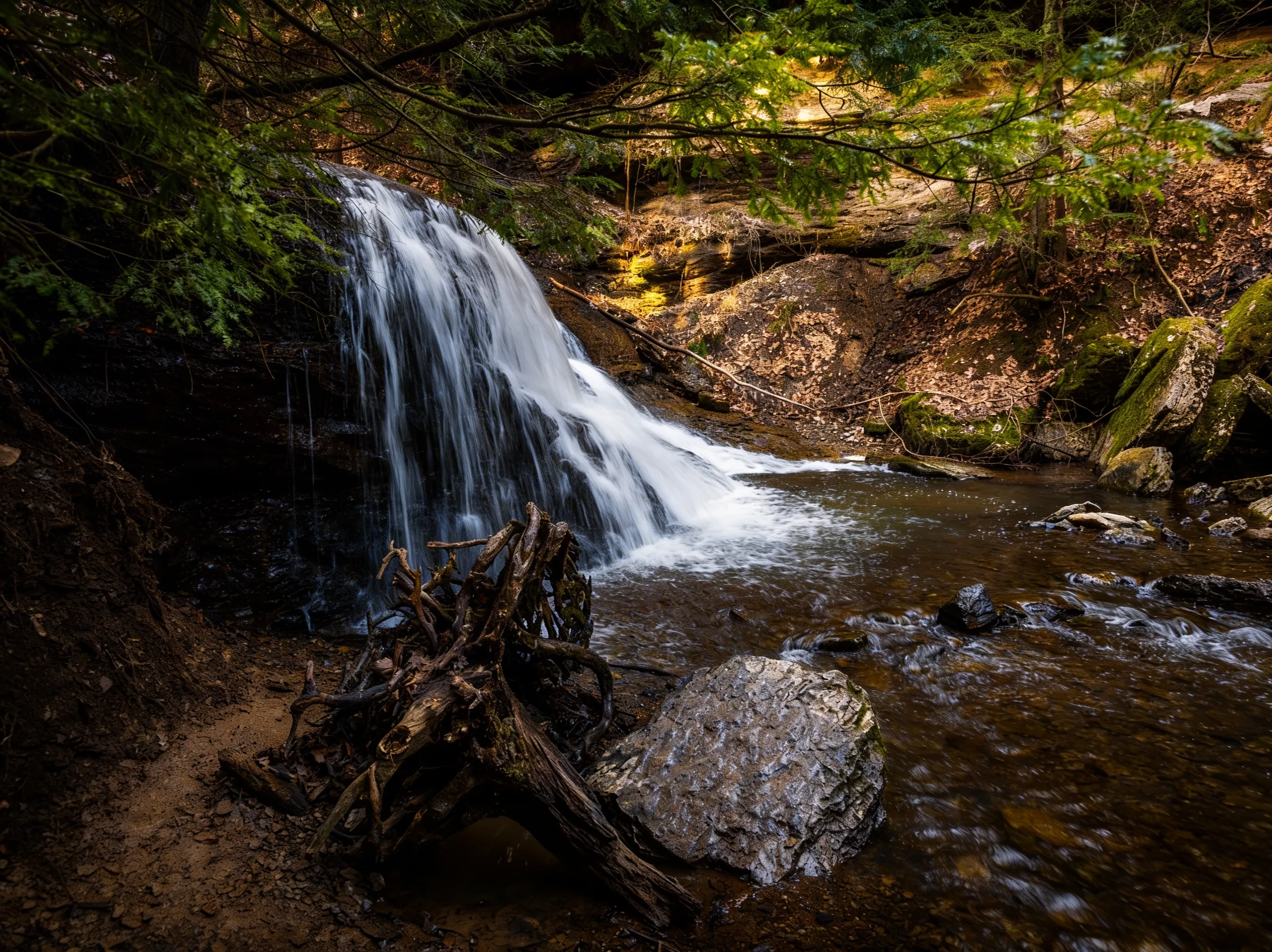
Hell’s Hollow Trail:
- Distance: 0.5 miles out-and-back
- Elevation: 100 ft descent
- Time: 20-30 minutes
- Difficulty: Easy to Moderate (some rocky sections)
- Trailhead: Hell’s Hollow parking area (separate from main mill area)
- Best Time: Spring (April-May) for peak water flow, early morning for fewer crowds
- The Draw: Hell’s Hollow Falls and a historic lime kiln
For a huge payoff with minimal effort, this is the spot. The trail follows Hell Run through a lush, green valley to a cascading waterfall. It’s significantly quieter than the main mill area.
The historic lime kiln near the falls is a remnant of the area’s industrial past. Built in the 1800s, it produced lime for mortar and agricultural use.
Pro Tip: Visit in early spring (April) when snowmelt creates the most dramatic waterfall. The falls can be a trickle by late summer.
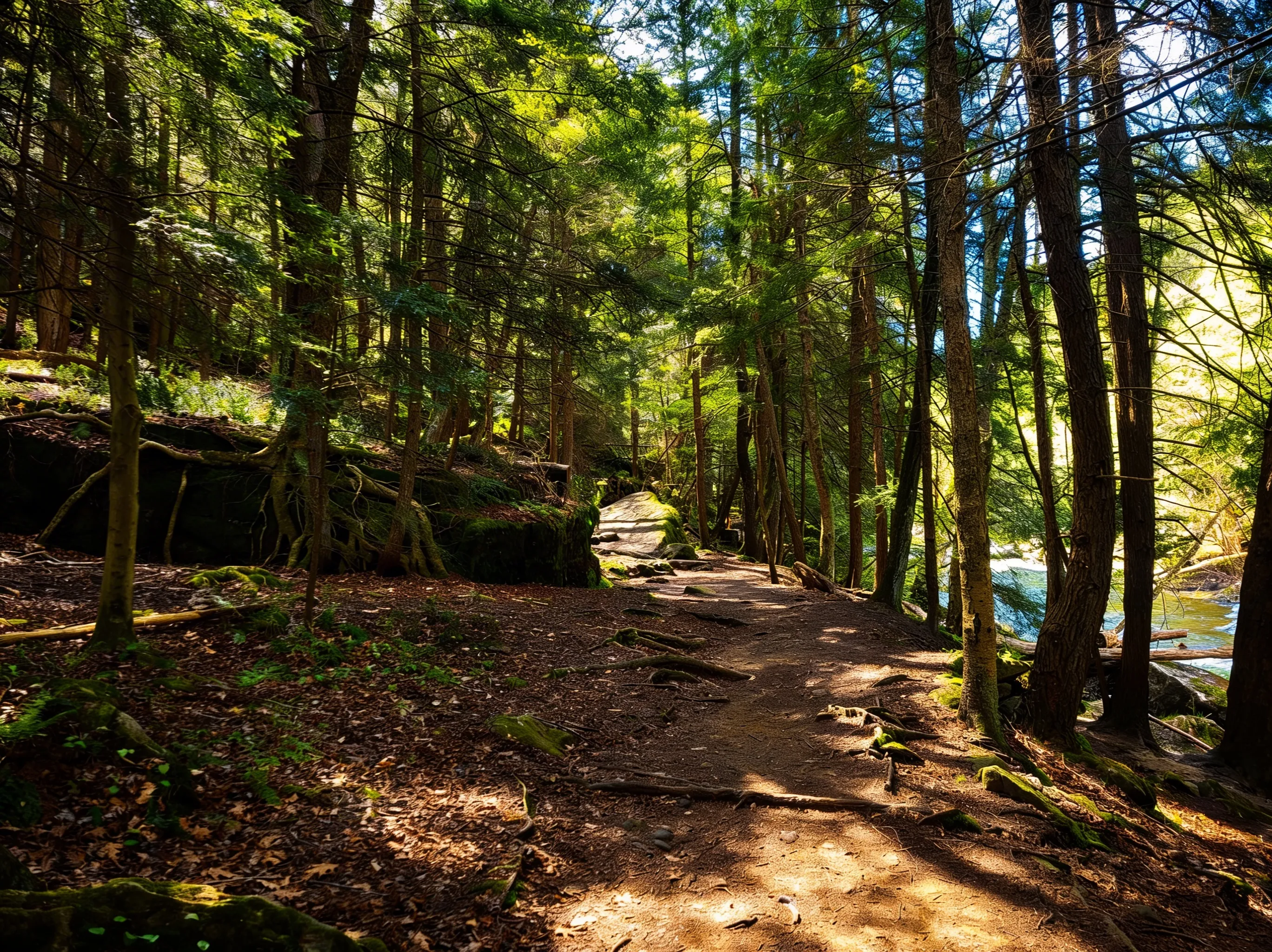
If You Want the Creek: Kildoo Trail
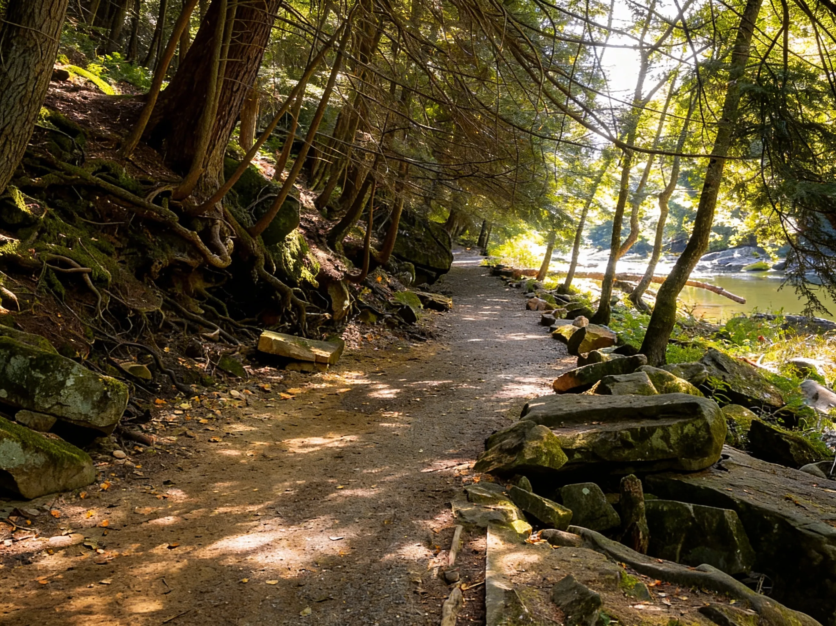
Kildoo Trail:
- Distance: 2.0 miles loop (with road connection)
- Elevation: 150 ft
- Time: 1-1.5 hours
- Difficulty: Moderate (very rocky, hugs the creek)
- Trailhead: McConnells Mill parking area (starts at the Grist Mill)
- Best Time: Summer (June-August) for cooler temps in the gorge
- The Draw: Intimate views of Slippery Rock Creek and the most dramatic boulder fields
This trail hugs the creek, offering constant views of the rushing water and massive boulders. It’s rockier than Hell’s Hollow but shorter than the full Gorge Trail - a perfect middle ground.
If You Want More Miles: Alpha Pass Trail
Alpha Pass Trail:
- Distance: 1.5 miles one-way
- Elevation: 200 ft
- Time: 1 hour
- Difficulty: Moderate
- Trailhead: Connects to Slippery Rock Gorge Trail
- Best Time: Fall (September-October) for foliage
- The Draw: A scenic section of the North Country Trail that leads to the “Alpha Pass” rapid area
This trail can be combined with the Slippery Rock Gorge Trail for a longer loop. It offers excellent views of the creek’s rapids and is popular with kayakers scouting the whitewater.
The Grist Mill: Living History
The McConnells Mill is the heart of the park. Built in 1852 by Daniel Kennedy and rebuilt in 1868 after a fire, it harnessed the power of Slippery Rock Creek to grind grain for the local community.
Innovation: In 1875, Thomas McConnell (the park’s namesake) purchased the mill and modernized it by replacing the water wheel with water turbines and the grindstones with rolling mills - making it one of the first rolling mills in the country. This innovation allowed the mill to process grain faster and more efficiently.
The mill operated until 1928, when outdated equipment and declining profits forced it to close. Today, it’s been restored to working condition.
Tours: The mill is open for interpretive tours from Memorial Day through late September, Wednesday through Sunday, 10:30 AM to 3:30 PM. Seeing the massive gears turn and hearing the water turbines rumble is a highlight. Admission is free.
The Covered Bridge: 1874 Icon
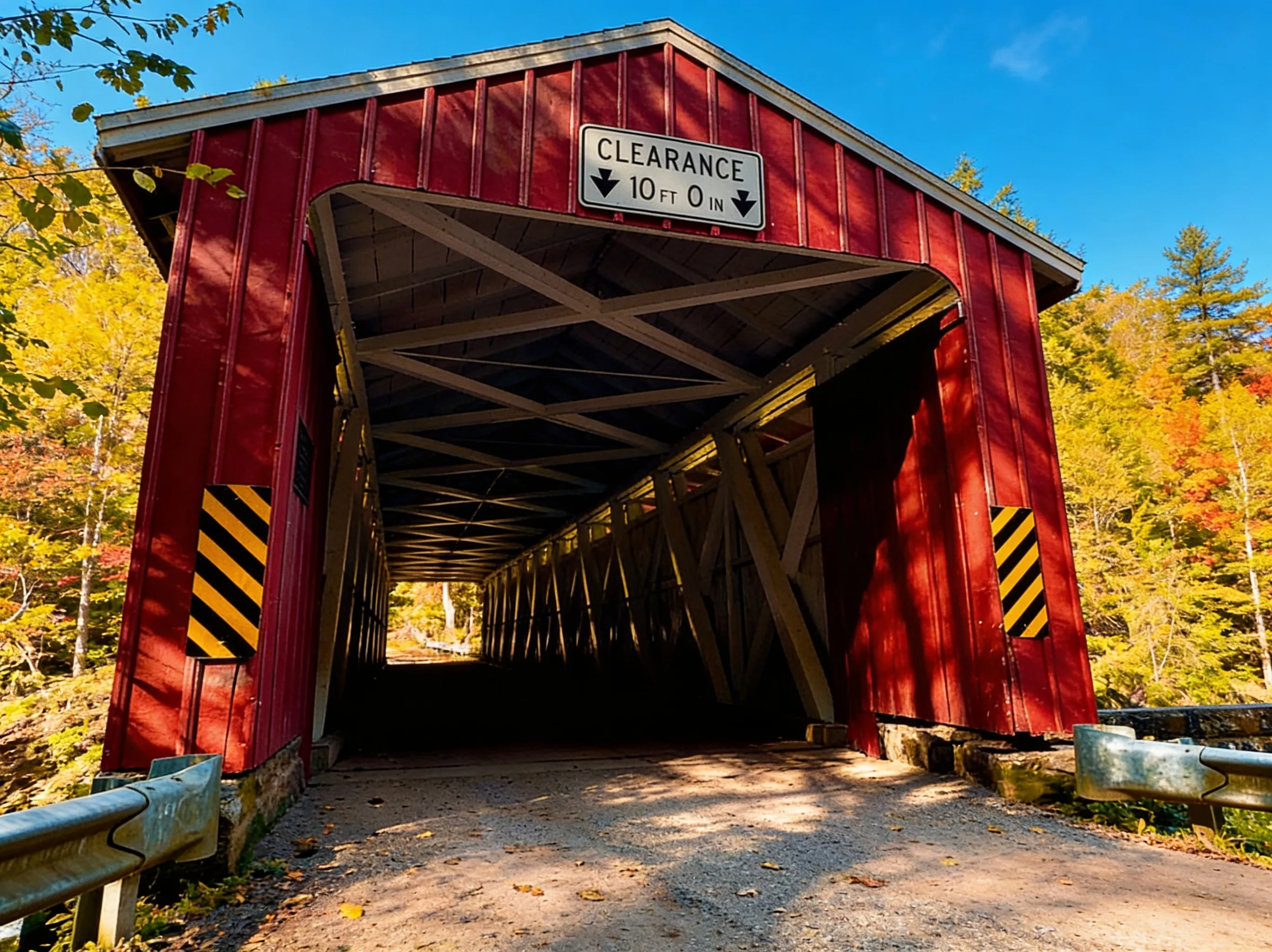
Spanning the gorge right next to the mill is the McConnells Mill Covered Bridge. Built in 1874, it uses a Howe truss design - one of only four remaining in Pennsylvania.
Specifications:
- Length: 91 feet
- Built: 1874
- Style: Howe truss (diagonal wooden braces with vertical iron rods)
- Status: Still open to vehicular and foot traffic (one lane)
- National Register: Listed on the National Register of Historic Places
Iconic View: The vibrant red wood against the green hemlocks and grey boulders is one of the most photographed scenes in Western PA. The bridge serves as the primary access point to the mill.
Photography Tip: Shoot from below the bridge (accessible via the Kildoo Trail) for the best angle. Early morning light (7:00-9:00 AM) illuminates the red bridge beautifully. Fall foliage (late September-early October) provides a stunning backdrop.
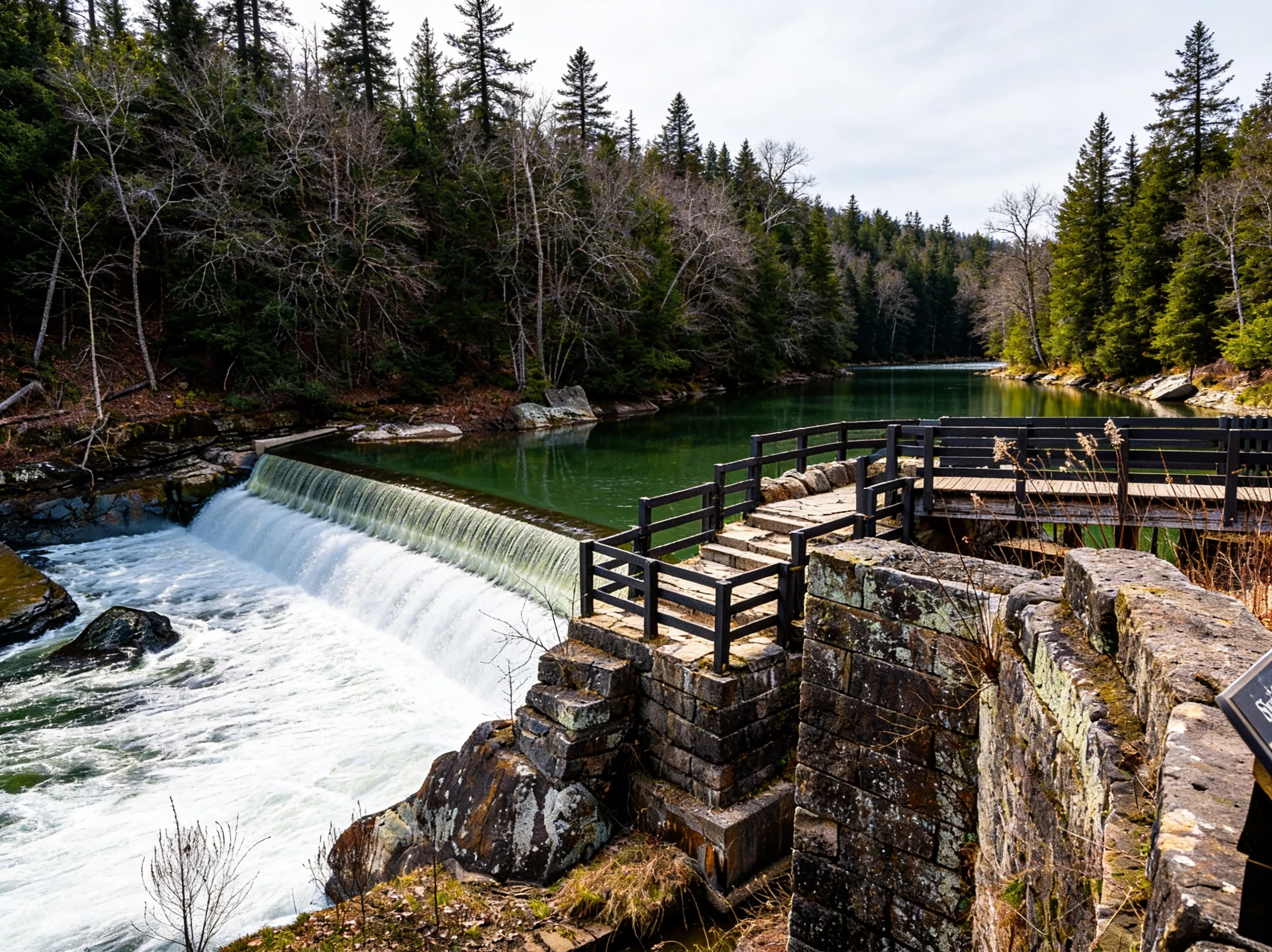
The Geology: Glacial Drama
The gorge wasn’t carved by a slow river over millions of years. It was blasted out in a geological instant. About 20,000 years ago, massive glacial lakes to the north (including what is now Lake Arthur at Moraine State Park) breached an ice dam. The resulting torrent of water - estimated at millions of gallons per second - drained southward, cutting through the bedrock and depositing the massive boulders you see today.
Glacial Lakes: The draining of glacial lakes Arthur, Watts, and Edmund created the gorge in a matter of days or weeks, not millennia.
Boulders: The massive sandstone boulders littering the gorge floor were carried by the floodwaters and deposited as the water slowed.
Designation: The entire gorge is a designated National Natural Landmark (1974) for its exceptional geological features.
Trail of Geology: Follow the self-guided interpretive trail to understand the rock formations. Markers explain the glacial history and point out key geological features.
Photography Tips
Best Gorge Photography: Shoot from the rim overlooks (accessible from the main parking area) in early morning (7:00-9:00 AM) for soft light. Use a wide-angle lens (16-35mm) to capture the depth and scale of the gorge. Fall (September 25-October 10) offers peak foliage.
Best Covered Bridge Photography: Shoot from below the bridge via the Kildoo Trail. Early morning light (7:00-9:00 AM) illuminates the red bridge. Include the mill in the background for context. Fall foliage provides a colorful backdrop.
Best Waterfall Photography: Hell’s Hollow Falls is best photographed in spring (April-May) when water flow is highest. Use a slow shutter speed (1-2 seconds) for silky water effect. Shoot from the base of the falls looking up.
Best Whitewater Photography: Capture kayakers navigating the rapids from the Kildoo Trail or Alpha Pass Trail. Spring (April-May) offers the most dramatic whitewater. Use a fast shutter speed (1/500 or faster) to freeze the action.
Whitewater Kayaking at Slippery Rock Creek
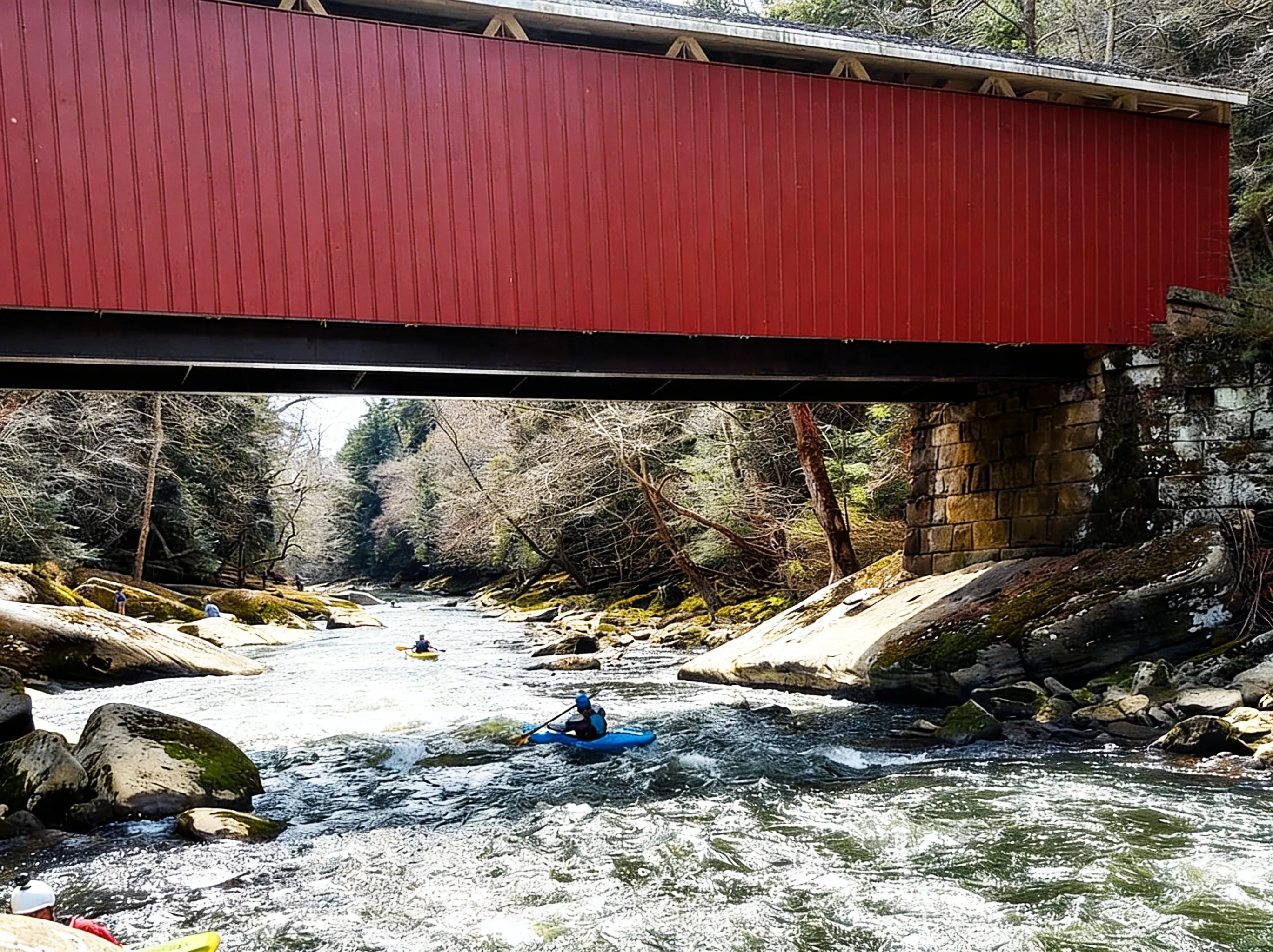
This is premier whitewater in Western Pennsylvania. The creek offers Class II to Class IV rapids depending on water levels.
Class: II-IV rapids (Class III-IV in high water, Class II in low water)
Season: Spring (March-May) for natural high flow, fall release schedules (check with local paddling groups)
Access: Multiple put-in/take-out points along the gorge (McConnells Mill, Eckert Bridge, Breakneck Bridge)
Difficulty: Advanced paddlers only. Technical rapids, boulder gardens, cold water, and undercuts make this dangerous for beginners
Permit: No permit required, but life jackets are mandatory
Water Levels: Check American Whitewater for current flow data before launching
Best Rapids: Alpha Pass, Breakneck Bridge, and the section below the mill offer the most technical whitewater.
Safety Warning: This is cold, technical whitewater. Undercuts and strainers are common. Only experienced paddlers should attempt this creek. Hypothermia is a real risk even in summer.
Rock Climbing
The rim of the gorge offers excellent sandstone climbing with routes ranging from beginner to advanced.
Areas: Rim Road Climbing Area (most popular), Breakneck Bridge
Rock Type: Sandstone cliffs (50-80 feet)
Routes: Traditional climbing, top-roping, and rappelling
Difficulty: 5.4 to 5.11 (varies by route)
Permit: No permit required, but climbers must use designated areas and follow Leave No Trace principles
Best Season: Summer (June-August) and fall (September-October) when the rock is dry
Popular Routes: The Rim Road area offers the most established routes. Consult local climbing guides or Mountain Project for specific route information.
What You Need to Know Before You Go
Nearby Hubs
- Portersville: Small town 5 minutes from the park. Gas, groceries, and basic services. Population ~300.
- Moraine State Park: 20 minutes away. Full services including camping, cabins, and Lake Arthur recreation.
- Pittsburgh: 45 minutes south. Full services, making this an easy day trip from the city.
The Rocks Are Slippery (Seriously)
The creek wasn’t named ironically. The damp environment of the gorge promotes algae and moss growth on the sandstone. Even dry-looking rocks can be slick. Injuries are common here. Ankle sprains and falls happen regularly.
Safety Tips:
- Wear boots with aggressive tread (not sneakers or sandals)
- Use trekking poles for stability
- Take your time on boulder scrambles
- Avoid the trails after rain when rocks are most slippery
No Camping
There is no camping in McConnells Mill State Park.
Solution: Stay at nearby Moraine State Park (20 minutes away), which offers modern cabins, group camping, and tent sites. Reservations can be made via PA State Parks reservations.
The Western Pennsylvania Conservancy Legacy
The Western Pennsylvania Conservancy played a crucial role in establishing the park in 1957. The organization purchased the land and donated it to the Commonwealth of Pennsylvania to protect the gorge and its unique geology from development.
Today, the Conservancy continues to support conservation efforts throughout Western Pennsylvania. Learn more at Western Pennsylvania Conservancy.
Nearby Attractions
- Moraine State Park: 20 minutes away. Features Lake Arthur (the refilled glacial lake that created the gorge!), 7-mile paved bike trail, and excellent boating.
- Pittsburgh: 45 minutes south. Full city amenities, museums, and dining.
- Portersville: Tiny village near the park entrance. Gas and convenience stores.
Best Time to Visit
- Spring (March-May): The water is high, making for dramatic falls and rapids. Wildflowers (trillium, bloodroot) carpet the gorge floor. Best dates: April 15-May 15 for peak water flow at Hell’s Hollow Falls.
- Summer (June-August): The gorge stays cool thanks to its depth and shade. It’s the best time for tours of the cool stone mill. Rock climbing is popular. Lower water levels make some rapids less technical.
- Fall (September-October): Spectacular foliage. The hardwoods on the gorge rim turn orange and red, contrasting with the dark hemlocks below. Fall whitewater release schedules bring kayakers back. Best dates: September 25-October 10 for peak color.
- Winter (December-March): For the adventurous. The mill closes for the season, but the ice formations on the cliffs and falls are stunning. Cross-country skiing is popular. The gorge is quieter and more isolated.
FAQ
Is the Slippery Rock Gorge Trail really that hard?
Yes. It is rugged, rocky, and long (6.2 miles one-way). Do not attempt it in flip-flops or sneakers. It is a backcountry hiking experience with boulder scrambles and stream crossings. Allow 6-8 hours for the round trip.
Can you drive across the covered bridge?
Yes. It is a single-lane bridge open to vehicle traffic. Be courteous to pedestrians and wait your turn if another car is crossing.
Is Hell’s Hollow worth it?
Absolutely. It is the easiest hike in the park and leads to a beautiful waterfall and historic lime kiln. It’s perfect for families or a quick stop. The hike takes only 20-30 minutes round-trip.
Can beginners kayak Slippery Rock Creek?
No. The creek has Class II-IV rapids and is for advanced paddlers only. The cold water, undercuts, and technical rapids make it dangerous for beginners. Consider hiring a guide or gaining experience on easier whitewater first.
When is the mill open for tours?
Memorial Day through late September, Wednesday through Sunday, 10:30 AM to 3:30 PM. Admission is free.
Explore More
Ready to explore Pennsylvania’s most dramatic glacial gorge? Start with Hell’s Hollow for an easy waterfall hike, then tackle the Slippery Rock Gorge Trail for a full-day adventure. Don’t miss the historic mill and covered bridge.
- Compare this to Ohiopyle for more whitewater and gorge hiking in Western PA
- Check out the Laurel Highlands for more mountain adventures in the region
- See the full PA State Parks list for more hiking adventures across the state
- Explore the North Country Trail for more long-distance hiking in Pennsylvania
Trails in McConnells Mill State Park: Slippery Rock Gorge, Covered Bridge & Glacial Geology
No trails found for this park yet.