PA Grand Canyon Hiking Guide: Trails, Overlooks & Planning Tips

Quick Facts
- Location: Tioga County (Wellsboro area, North-Central PA)
- Size: 47 miles long, 800+ feet deep
- Key Parks: Leonard Harrison (East Rim), Colton Point (West Rim)
- Best Trail: Pine Creek Rail Trail (62 miles, flat, biking heaven)
- Warnings: 4+ hour drive from major cities, no cell service in gorge, rattlesnakes on rims.
The PA Grand Canyon gives you two choices: stand on the rim at Leonard Harrison State Park with 200 other people taking the same photo, or drop 800 feet to the gorge floor where your phone becomes a paperweight and the only sound is Pine Creek. Most people pick the rim. The gorge is better.
Designated a National Natural Landmark in 1968, the gorge reaches depths of up to 1,450 feet. Visit PA DCNR for forest maps and check Pine Creek Outfitters for shuttle services.
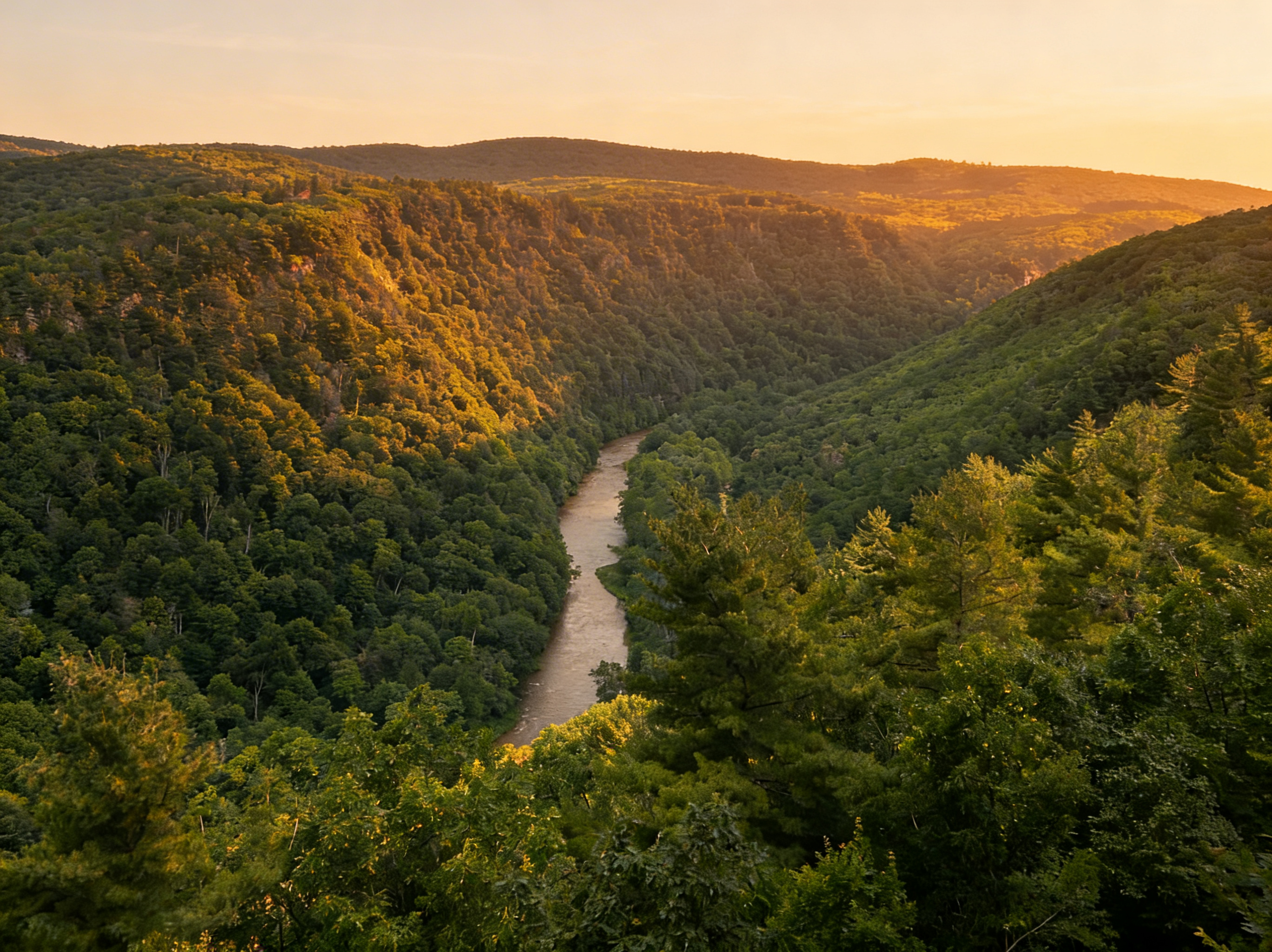
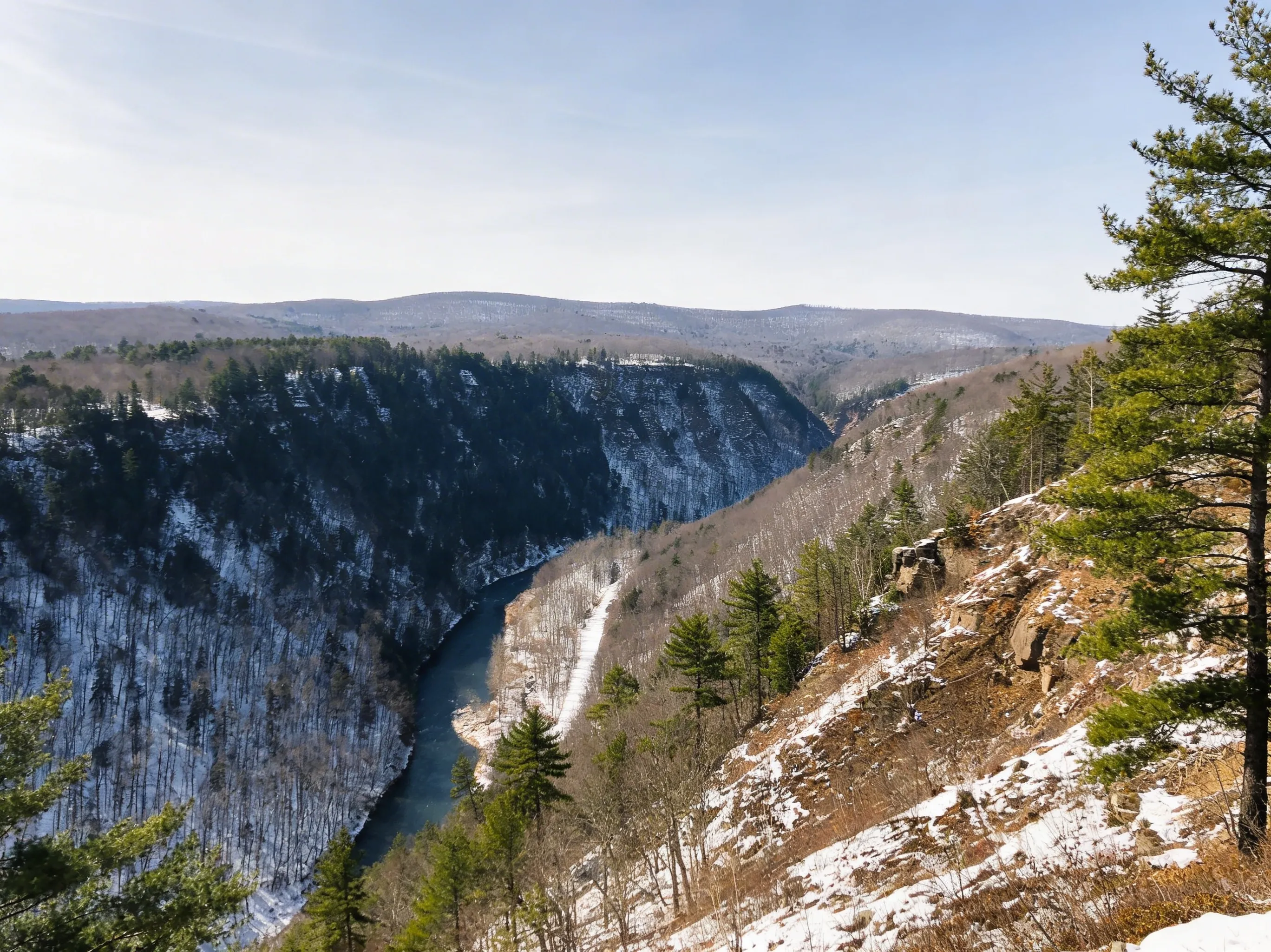 The PA Grand Canyon - a National Natural Landmark since 1968
The Eternal Debate: Leonard Harrison vs. Colton Point
The canyon is split by Pine Creek. You can drive between the two state parks in about 30 minutes, or stare at one from the other.
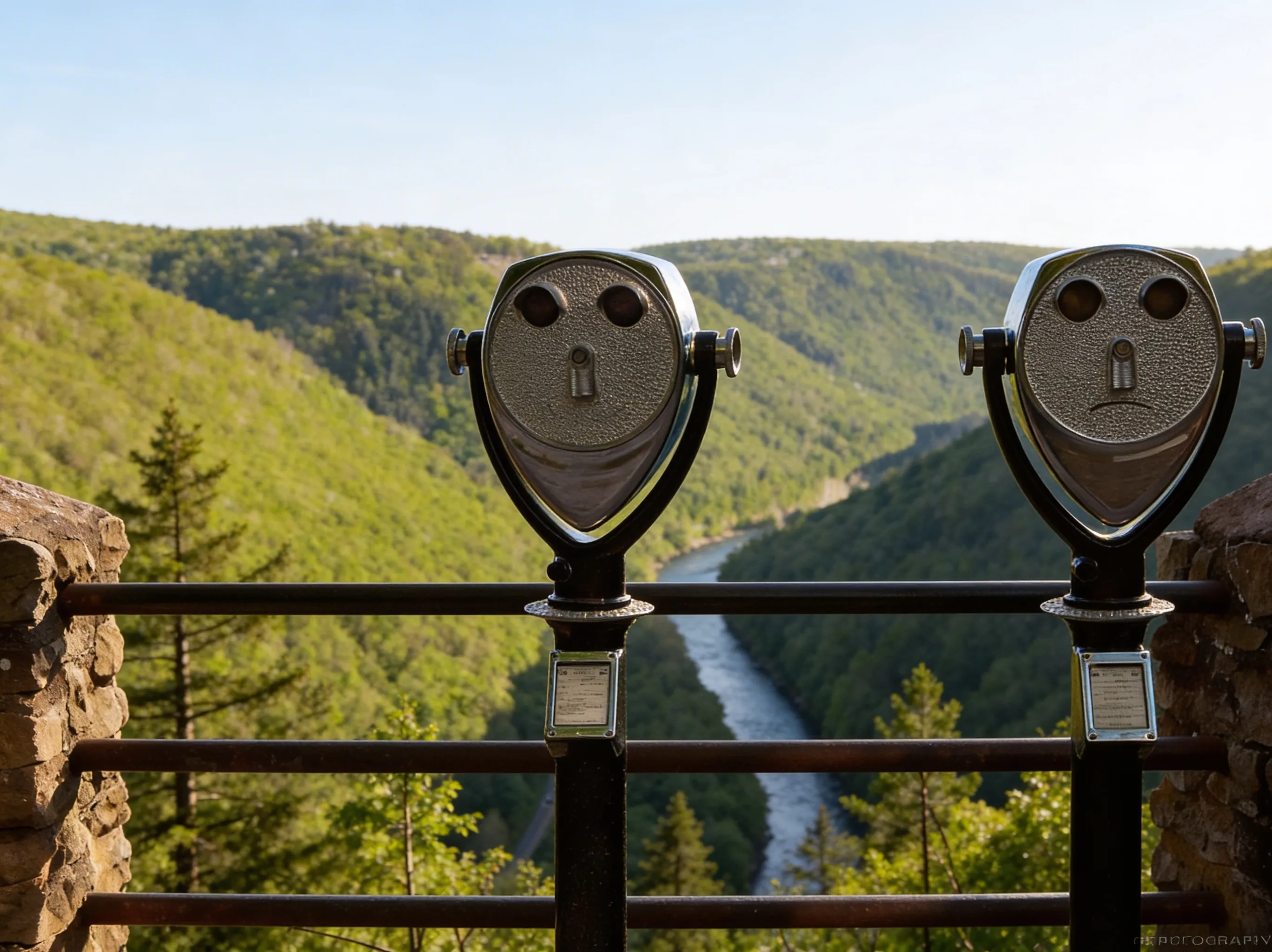
Leonard Harrison State Park (East Rim)
This is the postcard view. It has paved overlooks, a modern visitor center, and the classic “standing on the edge of the canyon” selfie. It’s crowded for a reason - the views are spectacular and accessible. The famous Turkey Path descends 800 feet to the gorge floor from here (steep switchbacks, waterfalls on Little Fourmile Run). Go here if you want amenities and the iconic shot.
Colton Point State Park (West Rim)
Rustic, CCC-era charm. The roads are gravel, the facilities are primitive (pit toilets), and there are far fewer people. The sunsets are better here because you face east across the gorge. The Rim Trail (1 mile) connects multiple overlooks. Go here if you want solitude and don’t mind roughing it a bit.
The Answer: Do Both. They’re 30 minutes apart. If you drove 4+ hours to get here, spend the extra 30 minutes.
 Colton Point State Park - rustic charm and quiet views on the West Rim
The Trails: Rim vs. Gorge
Rim Trails (Easy Access, Big Views)
- Barbour Rock Trail (0.7 miles, ADA accessible): The secret weapon. It offers Leonard Harrison-quality views without the Leonard Harrison crowds. It’s on the West Rim near Colton Point.
- Rim Trail at Colton Point (1 mile): An easy walk connecting multiple overlooks. Quiet and scenic.
- Otter View at Leonard Harrison (0.6 miles): A short walk from the main overlook to a south-facing vista.
Gorge Floor (The Real Adventure)
- Pine Creek Rail Trail (62 miles, flat): This is why people come. It’s crushed limestone with a 2% grade, rated one of the best bike trails in the USA by USA Today. The trail runs from Wellsboro Junction south to Jersey Shore, but the most scenic section is the 16-mile stretch from Ansonia to Blackwell through the heart of the gorge.
- Distance: 62 miles total (most popular: Ansonia to Blackwell, 16 miles)
- Time: 2-4 hours biking, 5-7 hours hiking (for the 16-mile section)
- Best Access Points: Ansonia (northern), Blackwell (southern), Rattlesnake Rock (mid-point)
- Pro Tip: Rent a bike from Pine Creek Outfitters in Wellsboro. They offer shuttle services so you can ride one-way downhill. The section from Darling Run to Blackwell is the most secluded. Bald eagles are common along Pine Creek in winter (December-February).
- Turkey Path (2 miles out-and-back, strenuous): The steep descent from Leonard Harrison to the gorge floor. This is the most popular hike in the canyon - it passes multiple cascading waterfalls on Little Fourmile Run and connects to the Pine Creek Rail Trail at the bottom.
- Distance: 2 miles round trip (1 mile each way)
- Elevation: 800 ft descent (and 800 ft climb back up)
- Time: 2-3 hours round trip
- Difficulty: Strenuous (steep switchbacks, rocky, slippery when wet)
- Seasonal Closure: Closed from Thanksgiving to April due to ice and erosion
⚠️ Warning: The Turkey Path often closes for repairs. Check current conditions at the Leonard Harrison Visitor Center before you commit. The climb back up is brutal - bring trekking poles and plenty of water.
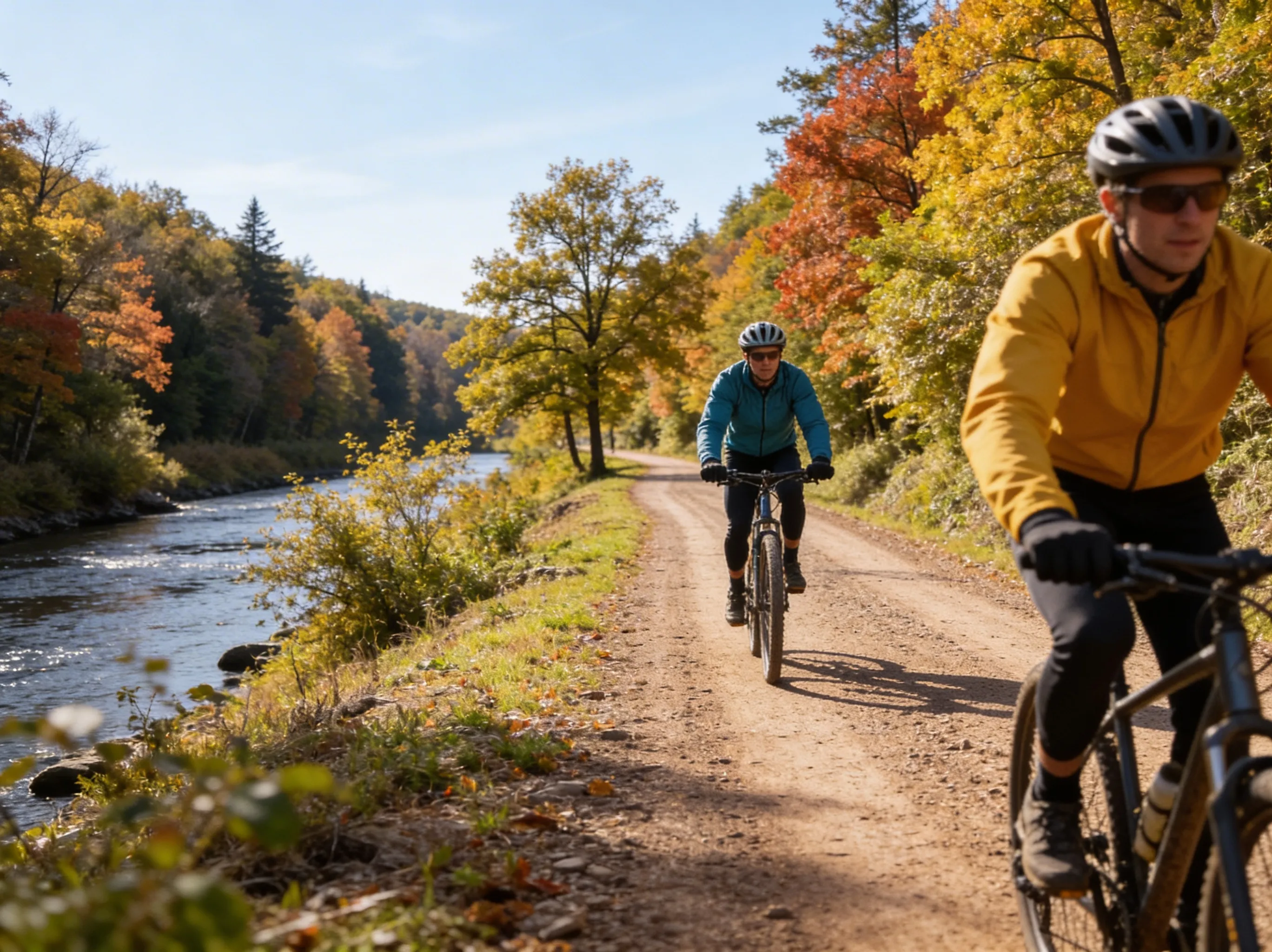 Pine Creek Rail Trail - voted one of the best places to bike in the world
Backpacking (For the Committed)
- West Rim Trail (30 miles, moderate to strenuous): Outside Magazine called it “the best hike in Pennsylvania.” This point-to-point trail skirts the western rim of the canyon with dramatic overlooks of Pine Creek Gorge.
- Distance: 30 miles point-to-point
- Elevation: ~5,600 ft cumulative gain
- Time: 2-3 days backpacking
- Trailheads: North: Colton Road (near Ansonia), South: PA Route 414 (Rattlesnake Rock)
- Highlights: Barbour Rock vistas, old-growth hemlock groves, canyon overlooks
- Camping: Primitive campsites throughout (first-come-first-served, no permit needed for single-night stays)
- Water: Multiple streams (filter required), Bradley Wales picnic area has potable water at the midpoint
- Shuttle: Required for point-to-point hike. Pine Creek Outfitters offers shuttle services (call ahead for pricing).
- Pro Tip: The northern section from Colton Road to Barbour Rock (about 6 miles) makes an excellent day hike if you’re not ready for the full 30-mile commitment. Bring a map - cell service is non-existent.
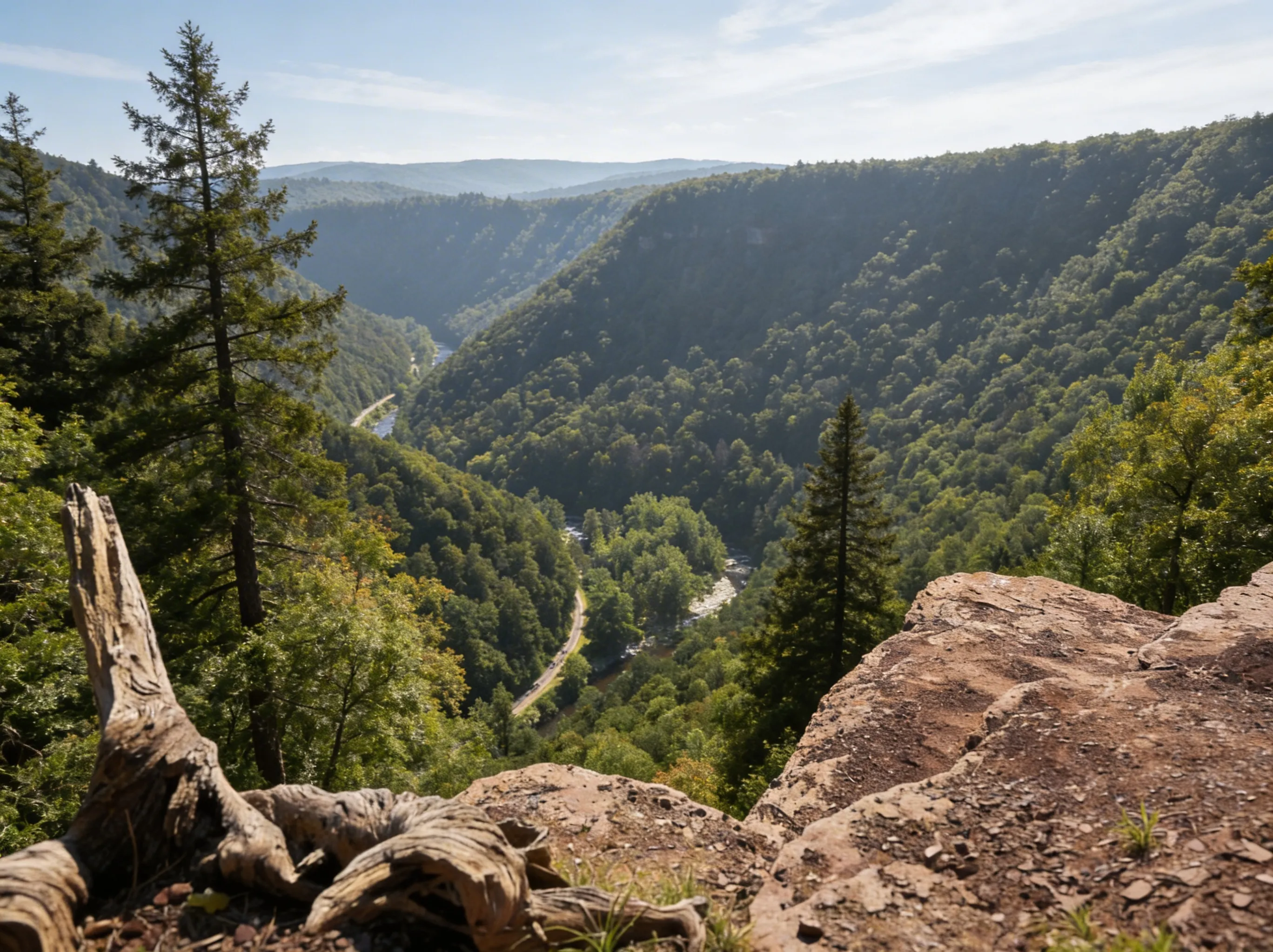 West Rim Trail - 30 miles of rugged backpacking along the gorge
What You Need to Know Before You Go
It’s a Weekend Trip, Not a Day Trip
The PA Grand Canyon is 4+ hours from Philadelphia and Pittsburgh. You’re not doing this as a quick morning jaunt. Plan to stay overnight in Wellsboro (quaint gaslight town) or camp at Colton Point.
Cell Service Is Dead
It is non-existent in the bottom of the gorge. On the rims, it’s spotty at best. Download your maps before you arrive.
Winter Closes Colton Point
The seasonal roads to Colton Point are often unmaintained or closed in winter. Leonard Harrison stays open year-round, though the Turkey Path may be icy.
Rattlesnakes Are Common
Timber Rattlers love the sun-warmed rocks on the overlooks and the West Rim Trail. Watch where you step and give them space.
Camping & Lodging
Colton Point State Park Campground: 25 sites, first-come-first-served (no reservations). Primitive facilities (pit toilets, no showers). Sites are $20/night. The campground is rustic but offers direct access to rim trails and overlooks.
Wellsboro: The charming gaslight town is 10 miles from Leonard Harrison. It has hotels, B&Bs, and restaurants. It’s the best base if you want amenities after a day of hiking.
Primitive Camping: Allowed along the West Rim Trail for backpackers (no permit needed for single-night stays). Practice Leave No Trace principles.
Best Time to Visit
- Fall (Best for Foliage): Peak season. The gorge explodes with orange and red, typically October 10-20 (varies by year and elevation). Expect massive crowds at Leonard Harrison on weekends. For quieter fall colors, visit Colton Point or hike the West Rim Trail midweek.
- Summer (Best for Biking): Warm weather, perfect for biking the Rail Trail. Still crowded on weekends. Bald eagles are less common, but the creek is perfect for cooling off.
- Spring (Best for Waterfalls): Waterfalls are flowing on the Turkey Path and Little Fourmile Run. Wildflowers bloom late April to May. Fewer people, but Turkey Path may still be closed until April.
- Winter (Best for Solitude): Leonard Harrison is open, but Colton Point is often inaccessible due to unmaintained roads. The gorge is quiet and beautiful if you can handle the cold. Bald eagles are common along Pine Creek (December-February).
Photography Tips
Best Sunrise: Colton Point State Park. You’ll be facing east across the gorge, with the sun rising behind the East Rim. Arrive 30 minutes before sunrise for the best light.
Best Sunset: Leonard Harrison State Park. The west-facing overlooks catch the golden hour light perfectly. The main overlook gets crowded, so try Otter View for a quieter spot.
Waterfall Photography: Turkey Path Trail. The cascading waterfalls on Little Fourmile Run are best photographed in the morning when the light filters through the trees. Bring an ND filter for silky water effects.
Fall Colors: Mid-October is peak. Shoot from the overlooks in late afternoon for warm, golden light. The West Rim Trail offers more intimate forest shots.
Bald Eagles: Winter mornings (December-February) along the Pine Creek Rail Trail. Bring a telephoto lens (300mm+) and look for them perched in trees along the creek.
FAQ
Which rim should I visit? Leonard Harrison for the classic view and amenities. Colton Point for solitude. Both if you have time.
Can you drive to the bottom? No public roads run along the river bottom. You drive to access points (access areas like Blackwell or Rattlesnake Rock) and walk or ride from there.
Is it free? Yes, admission to both state parks is free.
How long does it take? You can see the main overlooks in 2 hours. Hiking or biking takes a full day.
Explore More
- Explore more trails in Tioga State Forest beyond the canyon
- Check out Ricketts Glen State Park for Pennsylvania’s best waterfall hikes
- Visit the Poconos region for more waterfalls and family-friendly trails
- Explore the Laurel Highlands for whitewater and rugged wilderness
Parks in PA Grand Canyon Hiking Guide: Trails, Overlooks & Planning Tips

All Trails in PA Grand Canyon Hiking Guide: Trails, Overlooks & Planning Tips
Turkey Path: Down is Easy, Up is Hell
800 feet down into the PA Grand Canyon is easy. The climb back is brutal. Here's what to expect on the Turkey Path.